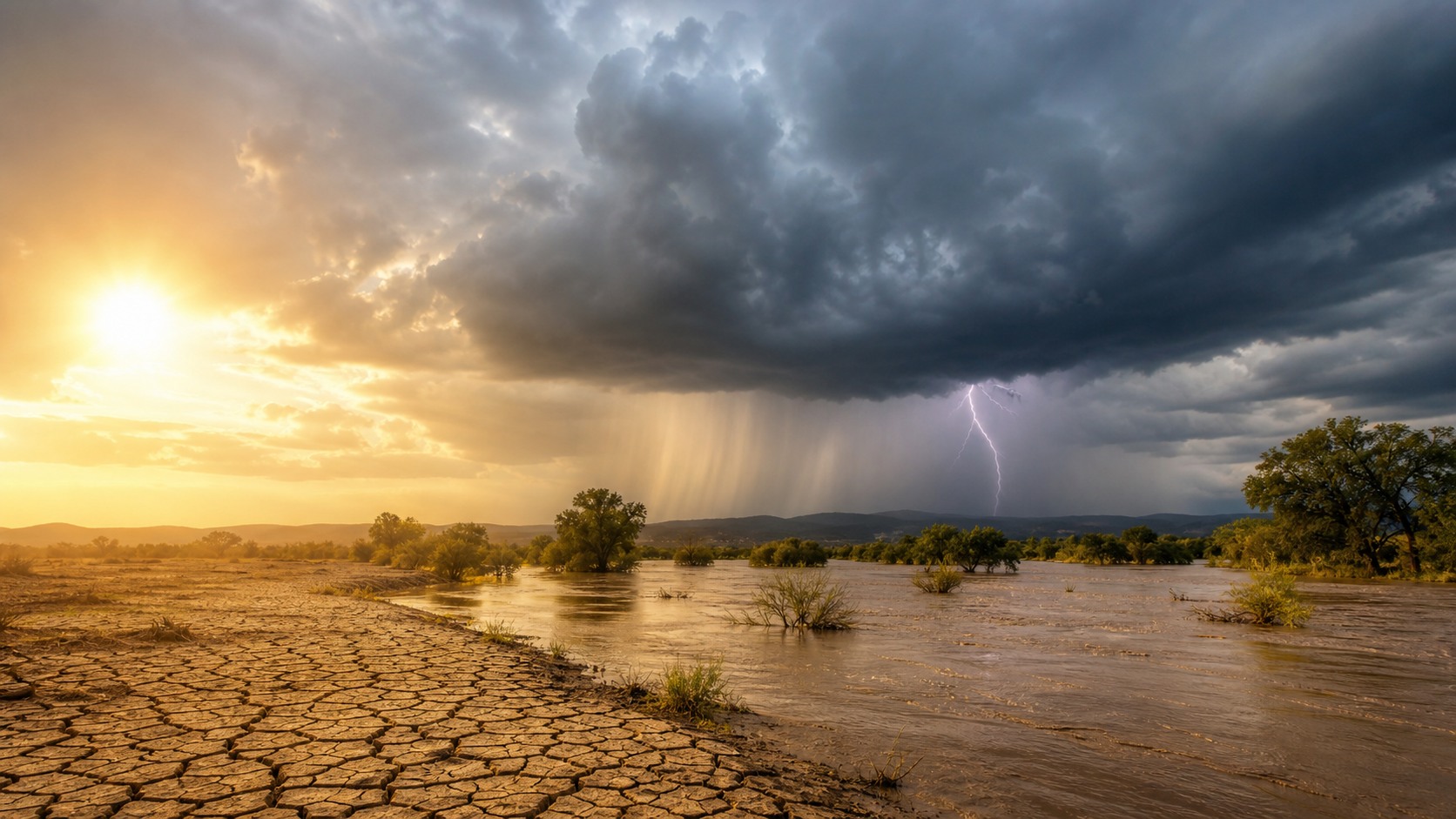
Extreme weather is weather outside the usual range
Extreme weather is not a separate kind of weather. It is ordinary weather pushed far enough that it can damage homes, strain health, disrupt travel, close schools, threaten crops, or put lives at risk. A hot day becomes an extreme heat event when the heat is intense, lasts long enough, or arrives in a place where people and buildings are not ready for it. A rainstorm becomes extreme when the water falls faster than the ground, drains, and rivers can handle. This article explains extreme weather in plain language: what it means, the most common types, what ingredients make events more dangerous, how warnings work, and why many risks are changing as the climate warms.
A: No. Extreme weather is what happens over hours, days, or seasons. Climate change is a long-term shift in conditions that can change how often some extremes happen or how severe they become.
A: One storm by itself does not prove the whole climate is changing. Scientists look at long-term patterns and compare how likely or intense events are in a warmer world.
A: Warming does not erase winter or local cold snaps. It changes the background conditions, so many places see fewer cold records over time while still having occasional dangerous cold.
A: Warmer air can hold more water vapor. When a storm forms, that extra moisture can help produce heavier downpours if the right weather setup is present.
A: Hot nights give the body less time to recover. That can raise health risks, especially for people without air conditioning or with medical conditions.
A: No. Coasts face hazards such as storm surge and sea level rise, but inland areas can face heat, hail, tornadoes, flash floods, drought, smoke, and winter storms.
A: It is when hazards overlap or follow each other in a way that makes recovery harder, such as wildfire smoke during a heat wave or flooding after a drought.
A: Risk depends on more than the weather. Housing quality, tree cover, drainage, health, income, transportation, and access to warnings all shape the outcome.
A: No forecast is perfect. Forecasts are best understood as guidance about likely conditions and possible hazards, with more uncertainty farther into the future.
A: Know your local hazards, sign up for alerts, keep basic supplies ready, and decide ahead of time where you would go for cooling, shelter, or higher ground.
What Makes Weather Extreme
Weather becomes extreme when it stands out from what a place usually experiences and creates a higher chance of harm. That means the same number can mean different things in different communities. A 95 degree day may be routine in one desert city and a serious health concern in a northern town where homes are built to hold heat and many people do not have air conditioning.
The word also depends on season and timing. Heavy rain on dry ground may run off quickly. A freeze after spring growth can damage crops even if the temperature would have been ordinary in January. Extreme weather is partly about the atmosphere, but it is also about people, places, and readiness.
A helpful way to think about it is to compare the event with local expectations. People prepare roads, homes, power lines, crops, and school schedules around the weather they usually get. When the weather falls far outside that range, normal routines stop working.
That local comparison also keeps the idea practical. People do not need a global record to be at risk; they need to know when conditions are unusual for their own bodies, buildings, roads, crops, or emergency services.
The Main Types Beginners Should Know
Heat waves are among the clearest examples. They happen when temperatures stay unusually high for a place, especially when nights remain warm. Heat can be dangerous because the body has to work harder to cool itself. The risk rises for outdoor workers, athletes, infants, older adults, people living alone, and anyone without a cool indoor space.
Heavy rain and flooding are another major category. Flash floods can happen within minutes or hours when rain falls too quickly. River floods may take longer to build, but they can last for days. Floodwater can hide washed-out roads, carry debris, and move with enough force to sweep away vehicles.
Storm extremes include severe thunderstorms, tornadoes, hurricanes, hailstorms, and high-wind events. Winter storms, drought, wildfire weather, smoke episodes, and coastal flooding also belong in the same broad family. They look different, but they share one idea: normal weather ingredients have combined in a way that raises danger. The categories are useful, but real events often blur them. A hurricane can be a wind event at the coast, a flood event inland, and a heat-health event afterward if power stays out.
The Ingredients Behind Extreme Events
Most extreme weather starts with familiar ingredients. Heat adds energy. Moisture feeds clouds, rain, snow, and humidity. Wind moves weather systems around and can turn a difficult day into a dangerous one. Lift helps air rise, cool, and form clouds or storms. None of these ingredients is unusual by itself.
Problems begin when the ingredients line up strongly, persist for a long time, or arrive in a vulnerable place. A thunderstorm with moisture, lift, and strong winds at different heights may become severe. A hot, dry, windy afternoon can turn a small fire into a fast-moving emergency. Rain over saturated soil can cause flooding even when the storm does not look dramatic on a radar image.
These ingredients are like parts of a recipe. Having one ingredient does not guarantee trouble, but when several arrive together, the result can become dangerous quickly. That is why forecasters watch combinations rather than one number alone.
Forecasters often describe these ingredients separately because each one changes the type of danger. Moisture can point toward flooding, instability toward thunderstorms, wind toward fire spread or tree damage, and cold air toward ice or snow.
Why Location Changes The Meaning
Extreme weather is local because every place has its own normal range. Cities with lots of pavement can hold heat after sunset. Mountain towns may see sudden snow, icy roads, or fast-changing winds. Coastal communities may worry about storm surge, high tides, and erosion. Low-lying neighborhoods may flood before nearby higher ground does.
Buildings and infrastructure matter too. A place with deep storm drains, shade trees, strong roofs, and reliable power may handle a storm better than a place without those protections. Two neighborhoods can experience the same rainfall and have very different outcomes because drainage, housing, and emergency access are different.
Personal circumstances also shape risk. A heat wave is more dangerous for someone who cannot reach cooling, pay an electric bill, or safely leave work. A flood warning is harder to act on without a car, clear evacuation route, or nearby shelter. Weather may be physical, but disaster risk is also social.
This is why simple labels can miss the point. A storm called moderate may still be severe for a household with a damaged roof. A heat advisory may sound mild but still be serious for someone taking certain medications. Local context turns forecast information into real-world meaning.
Local knowledge is valuable here. Residents often know which underpass floods first, which road drifts shut, which apartments overheat, or which stream rises quickly. Combining that knowledge with official alerts turns a broad forecast into a specific plan.
How Watches And Warnings Help
Weather alerts are designed to move people from awareness to action. A watch means the ingredients are present and a hazard could develop. It is the time to check plans, charge phones, bring items indoors, look at travel timing, or make sure someone vulnerable has support. A warning means the hazard is happening or expected soon, so the focus shifts from planning to protection.
Different hazards call for different actions. A tornado warning may mean moving to a small interior room on the lowest floor. A flash flood warning may mean avoiding low roads and never driving through water. An extreme heat warning may mean cooling the body, checking on others, and reducing outdoor exertion. The words attached to the alert usually matter more than the color on a map.
It helps to have more than one alert source. Phones can fail, power can go out, and cell service can be crowded during emergencies. Local weather offices, emergency management agencies, radio, trusted news sources, and weather radios can all play a role. The goal is not to follow every update all day, but to make sure urgent information can reach you.
Why Risk Is Changing
As the planet warms, the background conditions for weather are shifting. A warmer atmosphere can make heat extremes more likely and can allow the air to hold more moisture. That does not mean every storm is caused by climate change. It means the setting in which storms form is different from the past, so the odds and intensity of some events can change.
Heavy downpours are a good example. When more water vapor is available, storms that form in the right conditions can release more rain. This can strain drainage systems built for older rainfall patterns. Likewise, higher sea levels can make coastal flooding worse because storm water starts from a higher baseline.
Drought and wildfire risk can also change as heat increases evaporation and dries soils and vegetation. In some areas, snow melts earlier, warm seasons lengthen, or dry periods become more stressful. The exact changes vary by region, which is why local climate information is more useful than a single global statement.
The key beginner idea is simple: climate change often loads the dice. Weather still varies day to day, but some outcomes become easier to roll. Communities can reduce harm by cutting heat-trapping pollution and by adapting: improving drainage, adding shade, strengthening buildings, planning evacuation routes, protecting power systems, and making sure alerts reach everyone. This is why local planning matters as much as national headlines. The same warming trend can show up as heat risk in one place, heavier rain in another, and more stressful drought or fire weather somewhere else.
How To Think Clearly During A Hazard
During extreme weather, people often search for certainty. The better goal is useful action. Ask what hazard is expected, when it may arrive, where it is most likely, who is most exposed, and what simple step reduces danger now. That might mean delaying a trip, moving a car from a flood-prone street, checking on a neighbor, or going to a cooling center.
Do not wait for perfect information when official guidance is clear. Many dangerous events move faster than people expect, and small delays can close off safer choices. At the same time, avoid panic scrolling through every image or rumor online. Trusted local sources are usually more helpful than dramatic posts from far away.
It also helps to decide what you will not do. Driving through floodwater, working alone in dangerous heat, ignoring evacuation guidance, or waiting until the last minute can turn a manageable hazard into a crisis.
The Bottom Line
Extreme weather is best understood as weather that pushes beyond ordinary limits for a specific place, season, and community. It includes sudden events like tornadoes and flash floods, slow-building hazards like drought, and overlapping risks like heat combined with power outages. The details differ, but the pattern is the same: familiar weather becomes dangerous when intensity, exposure, and vulnerability come together.
You do not need technical training to understand the basics. Learn your local hazards, notice the difference between a watch and a warning, take alerts seriously, and remember that climate change is altering the background conditions for many extremes. Clear thinking before and during an event can turn a confusing forecast into practical choices that protect people.
The goal is not to be afraid of every forecast. It is to recognize when weather has crossed from ordinary inconvenience into a level of risk that deserves attention, preparation, and quick action.
That understanding is especially helpful for families, schools, workplaces, and neighborhoods. A short conversation before the season starts can decide who checks alerts, who checks on vulnerable people, and where everyone goes if heat, water, wind, smoke, or ice becomes dangerous. Even simple preparation can make forecasts less overwhelming because it turns a vague warning into a short list of actions. It also helps people talk about risk without blame or confusion. Extreme weather has always existed, but a warming climate changes the background odds, and better preparation changes how much harm those odds can cause. That combination is the heart of clear, practical climate awareness. It makes safety feel less mysterious and more manageable. before danger arrives locally