Freshwater habitats work as connected parts of a landscape
A river, a lake, and a wetland may appear to be separate places, yet water and living organisms often connect them. Rain falling upstream can carry sediment toward a lake, a seasonal flood can reconnect a river with its floodplain, and groundwater can sustain a stream long after the last storm. Fish, insects, birds, plants, and microbes use the resulting variety of flows and habitats. People depend on the same systems for water, food, livelihoods, recreation, and cultural relationships. Freshwater ecology begins with those connections rather than with a simple division between moving and standing water. Understanding how the parts interact explains why an apparently small change upstream can matter far away, why natural variation can support life, and why protecting a waterbody’s visible surface is only the beginning of protecting its ecological functions.
A: It includes the land draining toward a shared outlet.
A: Depth, velocity, substrate, shade, and connectivity also matter.
A: Seasonal saturation or flooding can sustain wetland functions.
A: Conditions can differ with depth, location, and season.
A: It can alter water exchange and habitat conditions.
A: Emerging insects and other movements connect water with land.
A: A reversing river connects the lake and floodplain with the Mekong, changing which habitats are accessible during the year.
A: No. Excess inputs can damage organisms or accumulate.
A: Barriers, flow, temperature, or habitat can remain limiting.
A: Contaminated sediment, altered habitat, or lost breeding access can persist while plants and animals begin to recolonize.
A watershed links land to water
A watershed is the area draining toward a shared outlet, although groundwater boundaries can differ from the surface boundaries drawn along ridges. Its land cover, soils, slopes, geology, and human uses influence the water reaching aquatic habitats. Rainfall does not arrive in a river as chemically empty water traveling across an irrelevant landscape. Along its route it encounters leaves, soil particles, nutrients, roads, farms, and settlements. The resulting inputs can support biological processes or introduce harmful excesses and contaminants. A watershed perspective therefore connects freshwater condition with decisions made well beyond the bank.
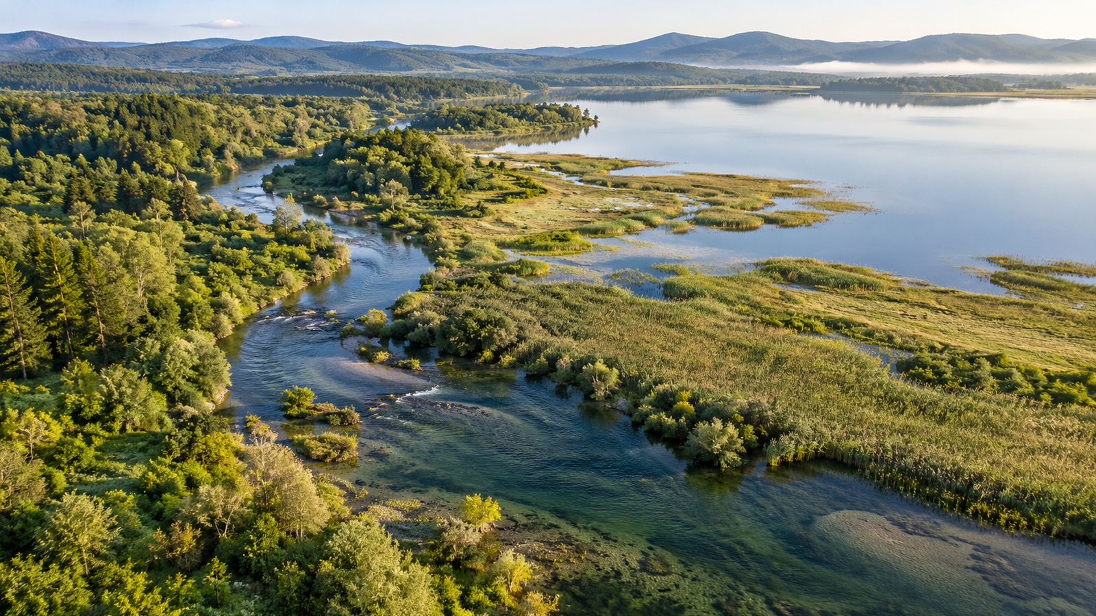
A headwater stream receives water from a relatively small surrounding area, while a large river combines flow from many tributaries. Each connection can carry a different mixture of sediment, organic matter, nutrients, and contaminants. A downstream reach may therefore experience changes originating well beyond its banks. Streamside vegetation can improve local shade and bank conditions, while upstream land use still affects the water arriving there. The river links those places through a moving supply, making downstream habitat part of a wider landscape rather than an isolated channel.
Flowing water creates a shifting collection of habitats
River channels contain pools, riffles, side channels, gravel bars, and other features shaped by flowing water and sediment. Different organisms use different velocities, depths, and substrates. Some cling to stones in currents, while others shelter in slower margins or deeper pools. The distribution changes with discharge, channel shape, woody material, and sediment supply. A river’s ecological character consequently depends on the variety and arrangement of these places, not only on the amount of water passing a gauge.
Changes in flow over time are equally consequential. Seasonal high water can move sediment, connect floodplain habitats, and create conditions that support reproduction or dispersal. Low flows produce their own constraints and opportunities. An environmental-flow assessment considers timing, duration, frequency, and rate of change as well as volume. A steady release that preserves the annual total may fail to reproduce the ecological effects of a more variable natural pattern. There is no universal hydrograph that suits every river, because species and channel forms developed under different regional conditions.
River connections run along the channel, sideways onto the floodplain, and below the bed into sediments and groundwater. Fish use some routes to move, while water and sediment move through others. A culvert can block an animal even when water passes through it; an embankment can prevent high flows from reaching habitat beside the channel. Improving passage can reopen a fish route without returning the floodplain connection or the sediment that shapes downstream features. Each restored connection supports a particular part of the living system.
Lakes contain contrasting environments within one shoreline
A lake contains shallow margins, open surface water, deep layers, and bottom sediments. Sunlight reaches only part of that depth, so plants and algae experience different growing conditions from organisms living near a dark bottom. In some lakes, warm surface water lies above colder water, restricting mixing until seasonal changes allow turnover. Oxygen can be consumed below the surface while nutrients released during decomposition remain separated from sunlit growth. Other lakes mix more frequently, and wind, shape, and climate change the pattern. A fish moving through a lake therefore encounters a changing combination of temperature, food, oxygen, and shelter. The ecological variety inside one shoreline can be as consequential as the contrast between separate lakes.
Wetlands occupy the meeting place of water, soil, and vegetation
Wetlands occur where water conditions create characteristic soils and biological communities. Some hold water for long periods, while others are flooded or saturated only seasonally. Their appearance varies from marshes and wooded swamps to peat-forming systems and temporary pools. A site does not need a permanent open-water surface to have wetland functions. Hydrology influences oxygen availability in soil, decomposition, plant communities, and the habitats available to animals. Seasonal wetness can therefore be ecologically meaningful even where a landscape looks dry during one visit.
Wetland vegetation slows some water movement and helps retain incoming particles, while wet soils support transformations of nutrients and organic matter. These processes operate alongside the feeding, breeding, and shelter functions described in the EPA’s wetland overview. Their capacity depends on how water passes through the site and how long it remains. A rapidly arriving flow may bypass some storage, while persistent contamination can accumulate in sediment or harm the organisms doing the ecological work. The wetland is a living part of the landscape, with its own requirements for water, soil conditions, and continued vegetation.
Groundwater keeps some surface habitats alive between storms
Water beneath the land can discharge into streams, springs, lakes, and wetlands, helping sustain habitats when direct runoff is low. In other settings, surface water seeps into the ground, and the direction of exchange may change with water levels. Groundwater’s influence is therefore a relationship rather than a universal one-way supply. Pumping, drainage, or changes in recharge can alter that relationship and affect surface habitats even when no pipe withdraws water directly from the stream. Temperature can also be influenced by spring inputs or groundwater exchange. Tracing these hidden links is essential to understanding why a stream has become warmer or less reliable, and why a wetland’s condition may depend on management beyond its mapped perimeter.
Food webs draw resources from both the water and the land
Algae and aquatic plants produce organic material where light and nutrients permit, while leaves and other material arriving from surrounding vegetation support additional pathways. In shaded headwaters, land-derived material can be especially consequential to food webs. Microbes and invertebrates process it, and their activity supports other consumers. This connection means that removing streamside vegetation can affect more than shade or bank stability. It can change the resources entering the ecosystem and the organisms able to use them.
Aquatic insects move resources back toward land when their immature stages develop in water and the adults emerge into the air. Birds, bats, spiders, and other animals can feed on that brief supply. Fish and amphibians connect habitats through movement and feeding, while waterbirds visit different wetlands across their seasonal journeys. An insect developing among streambed stones may consequently support a predator hunting above a bank weeks later. The food web extends across the shore through those successive stages, linking underwater conditions with life in the surrounding vegetation.
Algae and plants need nutrients, but additional nutrient loading can change the balance of a waterbody. A large growth pulse creates organic material that decomposers later process, consuming oxygen along the way. If that use outpaces replenishment, fish and invertebrates encounter increasingly difficult conditions even while the water appears full of plant life. Light, temperature, flow, and nutrient form influence the sequence. A more visibly productive surface can therefore coexist with a less habitable layer below it, connecting upstream inputs with effects that appear later in the food web.
Floodplains provide room for a river to interact with its surroundings
When high water reaches a floodplain, it can deposit sediment, move organic material, recharge some underground stores, and create temporary habitat. The ecological consequences depend on flood timing, duration, extent, and the characteristics of the floodplain. Natural flooding is part of the history of many river systems, but it can also endanger people and infrastructure placed in exposed locations. Recognizing ecological functions does not mean dismissing human losses. It helps identify where allowing space for water can support both habitat and risk management.
A floodplain disconnected by embankments or channel alteration loses some of its exchange with the river. Fish may no longer reach seasonal feeding grounds, and sediment that once spread over adjacent land stays within a narrower route. Reconnection can reopen some of those pathways where elevations and water levels allow it. Water still follows the local terrain, so different events inundate different areas and can threaten exposed homes or infrastructure. Providing room for ecological exchange works alongside measures protecting people, with land use shaped around the water’s likely routes rather than an assumption that any one project removes flood risk.
Multiple pressures often arrive together
Freshwater organisms often encounter several pressures together. Low flow can leave a fish in warmer water, while a barrier prevents movement toward a cooler tributary. Pollution or excess sediment can reduce the quality of the remaining refuge. Improving one condition gives the population more room to survive, but reproduction can still fail if another essential habitat stays inaccessible. The relationships between those pressures also change with the season. A channel that supports adults during ordinary flow may become a bottleneck during drought, when the few remaining deeper or cooler places take on a much larger role.
The sequence of pressures can change the outcome. A population recovering from an earlier disturbance may be more vulnerable when low flow or poor water quality arrives before recruitment has rebuilt its numbers. Habitat that functions as a refuge during one event can become especially valuable, even if it appears unremarkable during ordinary conditions. Protecting those recovery pathways can therefore be a priority alongside repairing the most visibly damaged location.
Earlier disturbances can leave effects that persist after the original activity stops. Contaminants remain in some sediments, and a modified channel may retain a simplified shape long after construction ends. Plants, invertebrates, and fish then recolonize within those remaining conditions rather than beginning in an undamaged habitat. If spawning grounds or shelter are still missing, recovery may proceed slowly despite cleaner incoming water. The time between removing a pressure and restoring a living community depends on those physical remnants and on the organisms able to reach the site.
Tonle Sap makes the river–lake connection visible
Cambodia’s Tonle Sap Lake is connected to the Mekong by the Tonle Sap River. During the wet-season rise of the Mekong, water can flow back along that river into the lake; as Mekong levels fall, water drains out again. The Mekong River Commission’s 2018 basin assessment describes this reversal. The result is a seasonal expansion and contraction of aquatic habitat, rather than a lake with one permanently fixed ecological shoreline. Floodplain vegetation and fish encounter a recurring change in which places are connected by water.
As floodwater spreads, ground that was exposed during the dry season becomes part of the lake–floodplain system. Fish gain access to newly inundated places, and vegetation experiences a different period of submergence along the flooding gradient. When the water recedes, the accessible aquatic area contracts again. Shifting the timing or duration of that cycle changes the places and resources available to organisms, even if a lake remains visible throughout the year. Tonle Sap’s seasonal life is consequently tied to the Mekong through the connecting river. Keeping those routes and suitable water conditions supports both the habitats and the communities whose livelihoods follow the flood pulse.